The Piilani Highway from Hana to West Maui is a must see
 | |
|
The guidebooks cautioned against driving on the Piilani Highway (aka Pi'ilani or Pilani Highway 31 or the back side of the Road to Hana), despite it being the most obvious, shorter and faster, way to come back to West Maui from Hana or Kipahulu. The rental car company said it would void the rental agreement, and we would be on our own in case the car breaks down. The numerous websites cautioned against dangers, deaths, closures, accidents, falling rocks, flash floods, unpaved and crooked roads, livestock on the road, and, failing all the above, the wrath of God in various forms.
May be for that reason, we had to see what Piilani Highway was all about.
And glad we did. For it remains our most memorable drives in Maui, along with the Kahekili Highway drive along the north west Maui coast. However, do check the current conditions and if the road status is open before you drive. There are closures at times, especially after a bad rainstorm.

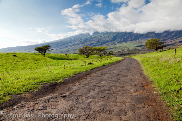
Piilani Haighway (also known as Hawaii State Route 31), is the road south of Mount Haleakala approximately between Ulupalakua and Kipahulu. On our trip to Hana, and beyond to Kipahulu, we drove back to West Maui on Piilani Highway. And we lived to tell the story. Believe me, Piilani Highway not half as scary as it is painted out to be, unless you are traveling the road during bad weather, or at night. Yes, its bumpy, one-and-a-half-lane-hugging-the-cliff at places, but its what memories are made of.
 | |
|
When we reached the blinding green Hana after a long and arduous drive, it was one in the afternoon. It was pouring in Hana, like they said it would. So we drove through Hana, and before we knew we were outside the town. The road started to get narrower slowly, and finally turned into one-and-a-half-lane windiness. There were houses along the road, with great views of the ocean. There appeared to be a large number of artists' studios. Perhaps such isolation breeds creativity. We drove past a lady aimlessly walking on the road. She had that hint of deep-rooted melancholy in her eyes. The creative kind, I thought to myself.

The first interesting diversion came a little later, round a bend called South Wailua. There was a tall waterfall (200 ft or so by various claims), called the South Wailua falls. It was pretty, wispy, and framed well by the foliage. There really was not all that much water falling down, which made it possible to walk down the short trail to get a closer look. It was perhaps the best waterfall we have seen on the road to Hana. The nearby roadside parking lot was overflowing with six or so cars, three of them red Mustang convertibles. We had to wait for some couple of minutes to find a spot to park our red Ferrari Enzo. Ah well, make it a regular-issue rental Dodge Jalopy or something. :-)
 | |
|
The next stop, not too far away, was the Haleakala National Park at Kipahulu. The piece de resistance here is Ohe'o Gulch and the Seven Sacred Pools. Oheo Gulch is where the Oheo stream comes down the mountain side to the ocean; on the way it flows over lava outcroppings, and forms these beautiful pools. There were people swimming in them, though its not recommended because of the common presence of Leptospirosis bacteria.
 | |
|
The Oheo Gulch area had very little water at this time, but its not always the case. Flash floods can occur that are known to raise the water level by some four feet in ten minutes.
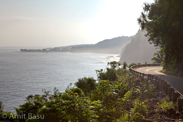
By the time we decided to leave Oheo Gulch to hit the Piilani Highway back to West Maui, it was 2:30pm. This is where the highway starts to get real hairy. The pavement disappears at places, and the road climbs to the cliff side, as it navigates Lelekea Bay. The mountain side is literally held by chains on the right at places, to avoid falling rocks from hitting the motorists. The hairpin bends are completely blind, but there is almost no traffic. If in doubt, honk. This road is not so bad; there are worse roads in the world that I have been on.
Once you have successfully navigated the sheer cliffs, blind curves, and unpaved roads, you reach Kaupo. The landmark of Kaupo, at least as seen from Piilani Highway, is the Kaupo general store. This being Christmas, it was shuttered. Thats a pity, cause I heard that they have a large collection of antique cameras.
Next, by the wayside is the St. Joseph's Church. You cannot miss it. It sits by the ocean, in its splendid isolation, and makes for some great photographs.
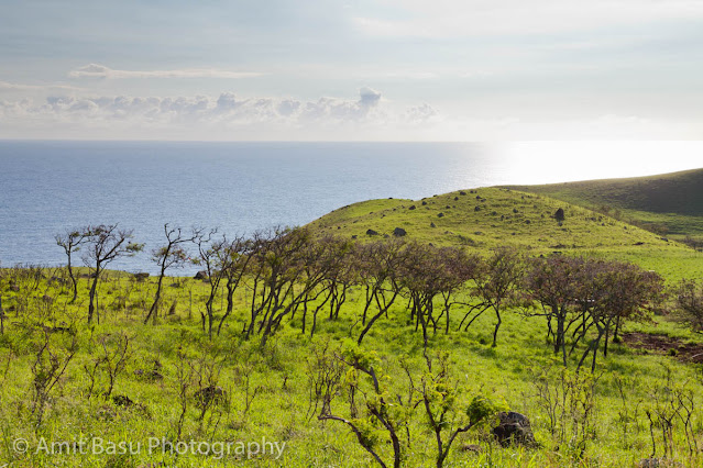
The next few miles on Piilani Highway are partially paved, but bumpy. The unpaved part is perhaps smoother. But, this is perhaps the most photogenic part of Piilani Highway in the afternoon sunshine, and what makes it absolutely worthwhile driving this road.
This beautiful part of Piilani Highway ends in some five or so miles, but the bad bumpy road continues for a few miles more. Meanwhile, we had a small stopover at the Nuu Bay, which had not much to offer but a black rock beach. There was a rumbling sound of lava rocks tumbling in the ocean waves and hitting each other underwater. We decided to stay out of the water, and drove on to see the Lava sea arches (or Natural Bridges by other accounts) by the roadside a few miles ahead.
Somewhere after the arches, the road suddenly became paved for a full 50 feet, and then turned unpaved again. There are also places where the road traverses a dry river bed, which definitely looks like may cause significant harm during a flash flood.
 | |
|
Next, by the wayside is the St. Joseph's Church. You cannot miss it. It sits by the ocean, in its splendid isolation, and makes for some great photographs.
 | |
|
 | |
|
The next few miles on Piilani Highway are partially paved, but bumpy. The unpaved part is perhaps smoother. But, this is perhaps the most photogenic part of Piilani Highway in the afternoon sunshine, and what makes it absolutely worthwhile driving this road.
This beautiful part of Piilani Highway ends in some five or so miles, but the bad bumpy road continues for a few miles more. Meanwhile, we had a small stopover at the Nuu Bay, which had not much to offer but a black rock beach. There was a rumbling sound of lava rocks tumbling in the ocean waves and hitting each other underwater. We decided to stay out of the water, and drove on to see the Lava sea arches (or Natural Bridges by other accounts) by the roadside a few miles ahead.
 | |
|
Somewhere after the arches, the road suddenly became paved for a full 50 feet, and then turned unpaved again. There are also places where the road traverses a dry river bed, which definitely looks like may cause significant harm during a flash flood.
Soon the road was fully paved, but without any shoulder, which made stopping anywhere difficult, or even dangerous. We were approaching an area marked on the map known as "Virginia's Place", and the road was climbing uphill in a wild up and down, winding kind of way. But we were getting closer to the south-west corner of East Maui island. It was about 5pm by this time. From the road you could see the cinder cones from the last eruption of Haleakala (circa 1790). They made a beautiful sight against the setting sun.
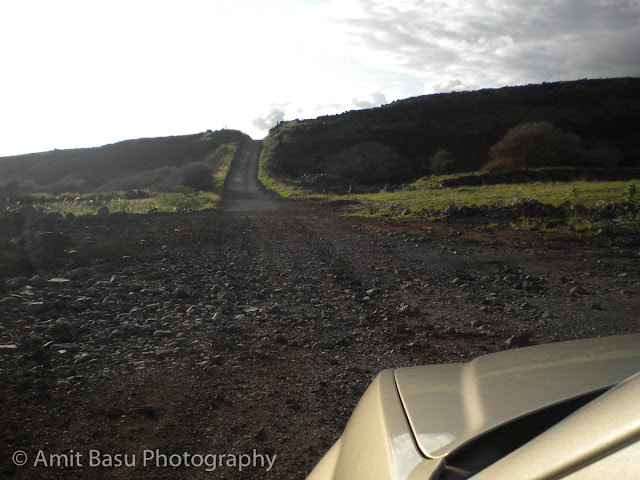
The road, meanwhile, was getting crooked in all kinds of strange ways. This is what the road at Mile 17 looked like. I don't believe I have seen a road like this anywhere else. Overall, the drive was as exciting as the Road to Hana drive. Glad we took the Pillani Highway back.
It was about sunset by the time we reached Ulupalakea. There was a beautiful orange glow all over the western sky, and so we decided to stop by the wayside and enjoy the sunset from our perch some 3000 ft above the ocean.
It was a glorious sunset over Maui.
 | |
|
The road, meanwhile, was getting crooked in all kinds of strange ways. This is what the road at Mile 17 looked like. I don't believe I have seen a road like this anywhere else. Overall, the drive was as exciting as the Road to Hana drive. Glad we took the Pillani Highway back.
It was about sunset by the time we reached Ulupalakea. There was a beautiful orange glow all over the western sky, and so we decided to stop by the wayside and enjoy the sunset from our perch some 3000 ft above the ocean.
It was a glorious sunset over Maui.


Comments
Those two rocky beaches look awesome.
Thanks for sharing, its been great seeing this place again.
Anyway, this drive is very doable and very very beautiful! Nice writing, by the way!
Man, I wish we had been as smart as you guys. Our first time to Hawaii, my mother and father had been before. There were 6 of us in the trip in a Dodge Caravan. We started out in Laihana (where our ship was tethered) and drove to a Subway to grab lunch for our trip. Our plan was the Road to Hana, look at some scenery, and eventually end up at O'heo Gulch. It was an awesome drive (even in dry season) and enjoyed every minute of it. We then proceeded to look at the gulch, and my crazy mother decided to take the hike up the mountain. 2 mile hike (each way), no big deal (except the end where your crossing a small river over rocks) and enjoyed the 400-ft Waimoku Falls. We then hiked back down.
This is where it got fun. We had wandered around pretty late and gotten back around sun down. My mother had always wanted to take the southern route, and with her GREAT sense of direction told us to take the southern route as it was aparently shorter than going back the way we came. She said it was rough for a few miles, but then became highway. This could not be further from the truth. So, I drove Piilani Hwy AT NIGHT in a minivan with 5 other passengers. It took us a little over 3 hours to get back down to Laihana lol. At the time it was a little nerve wracking overlooking 50 foot cliffs into the ocean, and we got stalled by a herd of cows that decided to take over the road, but all in all it was not terrible. Just be sure to take your time and go nice and easy. Especially in the part where the road floods out and a river forms and they warn of DEATH on a road sign. That was a new one.
All in all, not that bad and glad I got to experience it. However, next time, I will drive it in the daytime lol.